Precision Solutions: Cultivating Your Agricultural Success
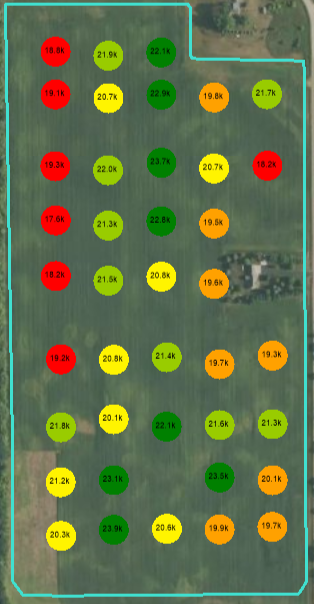
Stand Count
Using high-resolution aerial data, we provide precise plant counts, aiding farmers in optimizing planting practices and early-stage crop management for enhanced yields.
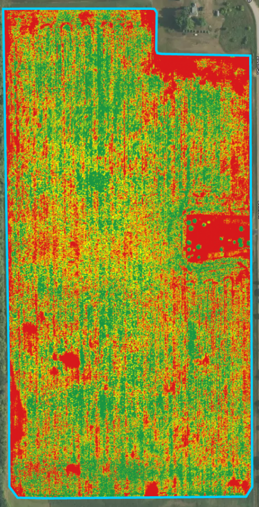
Plant Health
By capturing detailed plant data, we provide farmers with insights to proactively address issues, optimizing crop health and overall yield potential.
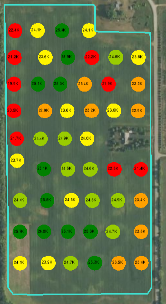
Tassel Count
Using high-resolution aerial data, we provide accurate tassel counts, helping farmers assess crop development during critical growth stages. This service aids in optimizing crop management and informs decisions on irrigation, fertilization, and harvesting to enhance yield potential.
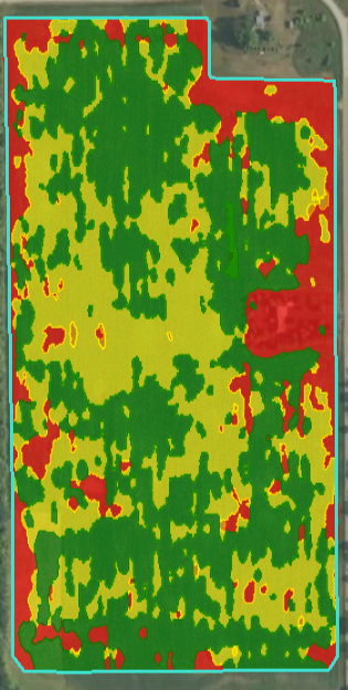
Zone Map
Using aerial imagery we can create detailed field maps, pinpointing variations in soil type, moisture, and crop health across farming areas. Using drone-captured data, we help farmers segment fields into zones, enabling targeted precision farming practices tailored to optimize resources and maximize yields.
Let's Connect: Reach Out for Precision Solutions
Contact Us: Your Gateway to Precision Solutions and Expert Guidance in Agriculture. Reach out today to explore how our tailored services can elevate your farming endeavors.